GET IN TOUCH (Sorry, we do not respond to WhatsApp inquiries.)
MLS #400175
PRICE$149,900
Belfry, Montana
tbd Roberts Trail E
Active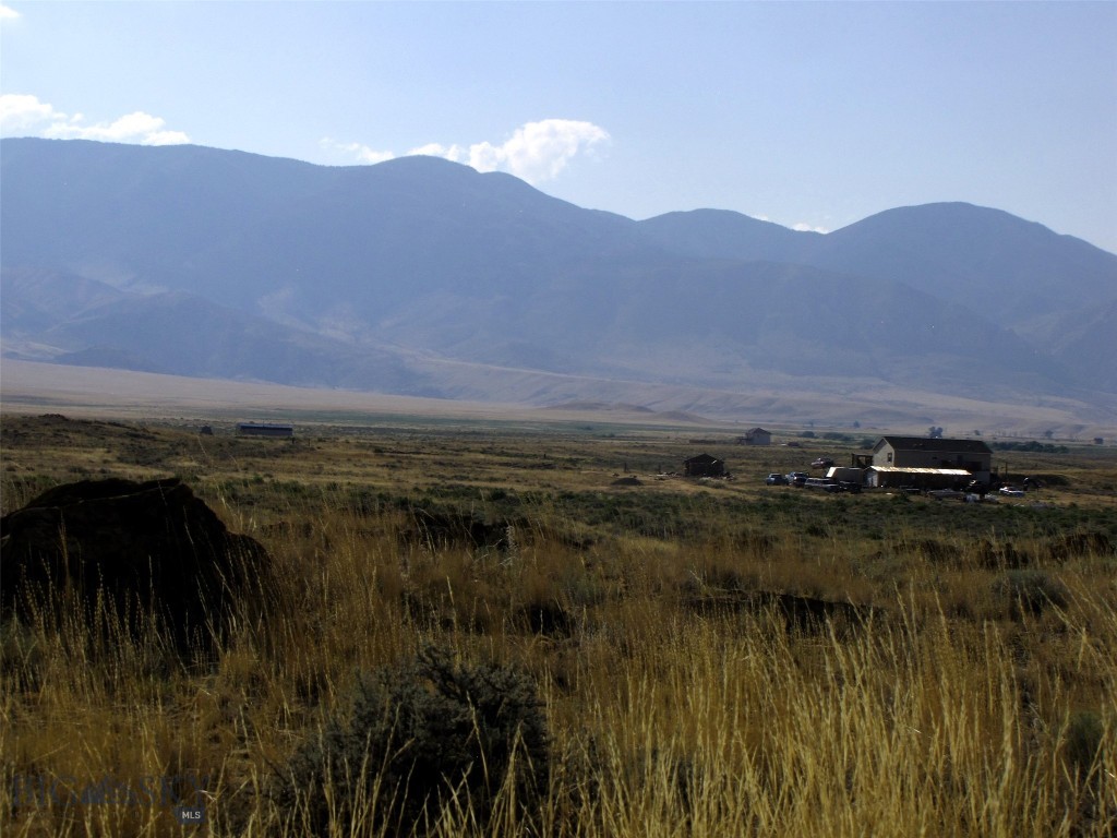
42Photos

Let me show you this listing!
Escape to Montana! Maybe these 21.9 acres at the end of the road and the foot of the Beartooth Mountains with Majestic Beartooth Mountain views would fit the bill. Power is 700 feet to the north and Hwy 72 is 4 miles to the east. It borders public land to the east and is a quarter mile south of 1000s of acres of public BLM land. It is 6 miles from the National Forest and a mile west of the Clarks Fork of the Yellowstone River. Belfry (pop 200) is only 13 miles away, while Red Lodge is 28 miles where there is a ski area. This property has views of the Pryor Mountains and Clarks Fork of the Yellowstone River valley as well as the Beartooths, the Abasaroka Mountains. Yellowstone National Park is 90 miles by road; Billings is just 60 miles to the northeast. This is a great area for for relocation or a getaway cabin! Mild covenants, but no HOA. Adjacent 22 Acre parcel is available. Owner financing with 25% down.
- Acres
21.9 - Days on Market
38
- Type: Land
- Subtype: Unimproved Land
- View: Mountains, Rural, Southern Exposure, Valley
Listing Provided By Mountainlands of MT Realty, Dean Petty
Additional Features
- City
Belfry - Contract Status Change Date
2025-03-12 - Cumulative Days On Market
205 - Directions
8.5 miles south of Belfry, rt on Chance Rd to Robertson Draw, a mile to T-turn right on Meeteetse Trail. Go 2 miles to Takota Lane, Left for 4/10 of mile to Roberts Trail, Left to end of road. - Fencing
Barbed Wire, Partial - Latitude
45.040769 - Listing Contract Date
38 - Listing Key
1108627792 - List Price
149900 - Longitude
-109.092738 - Lot Features
Adjacent To Public Land, Rolling Slope - Lot Size Acres
21.9 - Lot Size Square Feet
953964 - MLS Area Major
Other Counties/ State - MLS Area Minor
12 M - Other Montana Counties - MLS Status
Active - Original List Price
149900 - Originating System Name
S W M T - Parcel Number
0003324845 - Photos Count
42 - Postal Code
59008 - Property Sub Type
Unimproved Land - Property Type
Land - Road Surface Type
Dirt, Gravel - Standard Status
Active - Street Additional Info
Bvr 930-24 - Subdivision Name
Other - Tax Annual Amount
66 - Tax Legal Description
21.9 acres in Sec 14, TWP 09 S, RGE 21 E, TR 24 COS 930 in Carbon Cnty, MT Ref BVR 930-24 - Tax Year
2024 - Unparsed Address
tbd Roberts Trail E - Utilities
Electricity Available, Natural Gas Not Available - View
Mountains, Rural, Southern Exposure, Valley - View
Yes - Waterfront Features
None
Let me show you this listing!
Information provided by Big Sky Country MLS is compiled from miscellaneous sources. Neither the Association, listing brokers, agents or subagents are responsible for its accuracy. MLS users should be advised and should advise prospective purchasers to verify all information regarding the property by their own independent investigation prior to submitting an offer to purchase the property.
